The New Abnormal
Posted on Sept. 5, 2019
Hans Paerl has always been close to water, first in his native Holland and, for 40 years, on North Carolina’s coast. (Photo by Mary Lide Parker ’11)
As the eminent water quality scientist Hans Paerl reflects on his 40 years watching the North Carolina coast, he fears for what climate change could do to make delicate estuaries even more difficult to protect.
by David E. Brown ’75
The water scientist also is a waterman. He came to America from Holland when he was 11, from water people. He’s never lived more than a few miles from a big body of it, and for the past 40 years that’s been North Carolina water.
When the wind blows hard, the canopy of trees around his house sing a whooshing song while they protect him from it, but the trees cannot help with the water that got into his garage when Hurricane Florence pushed the North River through his neighborhood last September.
Storm-weary like thousands of coastal and inland residents, Hans Paerl wrote in a marine science journal earlier this year that “either North Carolina has been very unlucky, or the historical record used to define the storm statistics is no longer representative of the present climatic regime.” He meant not just Florence but a trio of flooding-packed storms, including Matthew in 2016 and Floyd in 1999.
For more than three decades between 1960 and the mid-1990s, talk of damaging hurricanes in the tourist and fishing paradise of Carteret County was mostly just speculation and remembrance. The area bounded on the east by the southernmost of the uninhabited Outer Banks had its share of mullet blows and nor’easters, but the catastrophes that befell Florida, Louisiana, South Carolina and even New York couldn’t seem to find the part of the southern United States that juts out toward the Gulf Stream.
Now this. Two 50-year floods and a 120-year flood in a span of 20 years. Science gives that less than a 2 percent chance, and yet here it is: Nine months after Florence weakened and spun away, some hotels, restaurants and other businesses, pounded for hours and hours by torrential rains and wind on the sunny island off Morehead City, still had not been able to reopen. Hardly a street had all roofs free of blue tarps in place of shingles. The beach rental business was down significantly because the houses weren’t available.

Paerl deploys a low-tech device called a Secchi disk to measure the transparency of the water. (Photo by Mary Lide Parker ’11)
Inland, far from the second homes, boats and pricey seafood dinners, entire communities still were struggling with interrupted basic housing and services — not all from Florence but also from Matthew two years earlier. About 70 North Carolinians lost their lives in the two storms.
Florence, Paerl said two weeks after it hit, “is by far the worst one. It sat out here for over 48 hours. And you know, when you have a storm with Category 1 winds for 48 hours and up to almost 20 inches of rain, you know things happen. And so the ground got saturated. That’s when a lot of the trees came down and snapped. We had a storm surge here that brought salt water into some people’s houses.”
Paerl has lived in Carteret since 1978, brought to UNC’s Institute of Marine Sciences by Dirk Frankenberg, then a rising star who was hired away from the University of Georgia to transform the IMS from what Paerl called a “sleepy fisheries lab” that the administration in Chapel Hill barely knew existed. Paerl can’t remember a hurricane making landfall in his first 15 years.
Now, he is afraid climate change has come calling at his home. And it’s not his garage he worries about; it’s the thing upon which he built his career: the impact of bad water in the state’s estuaries and large river systems on the fishery and tourism industries, indeed to the entire quality of life in the region.
The problems for North Carolina’s estuaries are the same ones Paerl and many others have preached about for years. Nutrients from stormwater runoff, agricultural fertilizers and wastewater disposal travel the rivers into the delicate estuaries — partially closed bodies of brackish water with connections to fresh water upstream and the ocean below. The nutrients feed the growth of algae.
Salt water mitigates the growth of the harmful blue-green algae (scientifically, cyanobacteria), but in the aftermath of a major storm, the fresh water running into the estuaries overwhelms the salt water, leaving a freshwater breeding tank for algae.
Furthermore, the heavier salt water goes to the bottom and collects whatever drops into it, including algae from the fresh water, which sinks as it dies and is trapped in the heavier water. The algae decays, consuming oxygen — the action is similar to a compost pile. The bottom water gets limited oxygen from the surface. It can become “dead water” — maybe just smelly or unattractive in color; worse, uninhabitable for fish and particularly shellfish, which cannot move; worse still, the organisms that form algal blooms can produce toxins that can lead to chronic diseases in humans such as liver disease, neurological problems and even death.
The difference now, with those three hurricanes all too fresh in the eastern North Carolina psyche, is that storms that exacerbate this damaging process appear to be growing in ferocity and frequency.
“The thing that really worries me about all this is that it seems like we’ve had a major event now an average of every two years, so the system is still recovering when the next insult happens to it.”
— Hans Paerl, Institute of Marine Sciences
That was the point of a paper Paerl and two colleagues on the West Coast published last spring in the journal Environmental Science and Technology: Nutrient over-enrichment is the enemy we knew. Rising temperature is the enemy we are coming to know.
“The rain and the hurricane data go back to 1898,” Paerl said. “That data is showing that not only are the number of events increasing, but now they’re delivering a whole lot more rain than they used to. Part of that has to do with warmer conditions. You ask yourself the question: How the hell can you have three events as severe within 20 years? That just doesn’t make sense. My conclusion is that we’re into a new normal. I know that word has been overused, but certainly it applies to what we’re seeing in terms of rainfall.
“The thing that really worries me about all this is that it seems like we’ve had a major event now an average of every two years, so the system is still recovering when the next insult happens to it.”
Trapped in a bathtub
As Paerl spoke in his IMS office, two days’ rain in Carteret County — 4.5 inches at his house — was just leveling off. It was an unusually wet winter, which partially explains why Florence repair work has dragged on for a full year, even in a coastal community where floodwaters recede quickly.
He and six colleagues wrote in a paper published this summer in Nature Scientific Reports, an open access journal published by Nature magazine, that the three floods caused “catastrophic human impacts from flooding and leading to major alterations of water quality, biogeochemistry, and ecological conditions. The apparent increased frequency and magnitudes of such events led us to question whether this is just coincidence or whether we are witnessing a regime shift in tropical cyclone flooding and associated ecosystem impacts.”
Paerl wrote that this trend, consistent with observations elsewhere, represents a recent change “with major ramifications for hydrology, carbon and nutrient cycling, water and habitat quality and resourcefulness” in the mid-Atlantic and possibly other U.S. coastal areas.
The three named hurricanes are just the worst of 36 tropical cyclones that have hit the state’s coast since the late 1990s.
Depending on the location within the watershed that drains about half of North Carolina’s coastal plain and about 20 percent of Virginia’s, Floyd and Florence created something between the 50-year flood and the 120-year flood — meaning the largest flood statistically expected to occur in those periods.
That suggests, Paerl wrote, that the extreme flooding “is a consequence of the increased moisture carrying capacity of tropical cyclones due to the warming climate.”
The lab has access to rain and hurricane data back to 1898, enabling researchers to study the impact of extreme conditions on water quality. (Photo by Mary Lide Parker ’11)
The flooding upstream causes what he calls “unprecedented” discharges of nutrients into the estuaries that don’t drain well into the ocean through a small number of narrow inlets. The nutrient-rich water is “trapped in a bathtub. The system becomes essentially a nutrient trap, causing algal blooms that persist for months, even years after the flooding has receded.”
Paerl’s lab measured a 60 percent increase in two primary nutrients, nitrogen and phosphorous, after Hurricane Floyd; after Matthew, a 30 percent increase. Florence, whose impact still is being assessed, dumped 30 inches
of rain in parts of the coastal zone.
“It’s almost like thinking about a slow fertilizer for your lawn. We had algal blooms in the Pamlico Sound after Floyd for, like, two to three years.” Floyd caused $19 million in fishing losses; many fishers gave up their livelihoods and didn’t come back.
“The shrimp catch and crab catches were off for about six years, so this whole thing sort of translates up the food chain.”
The plodding work
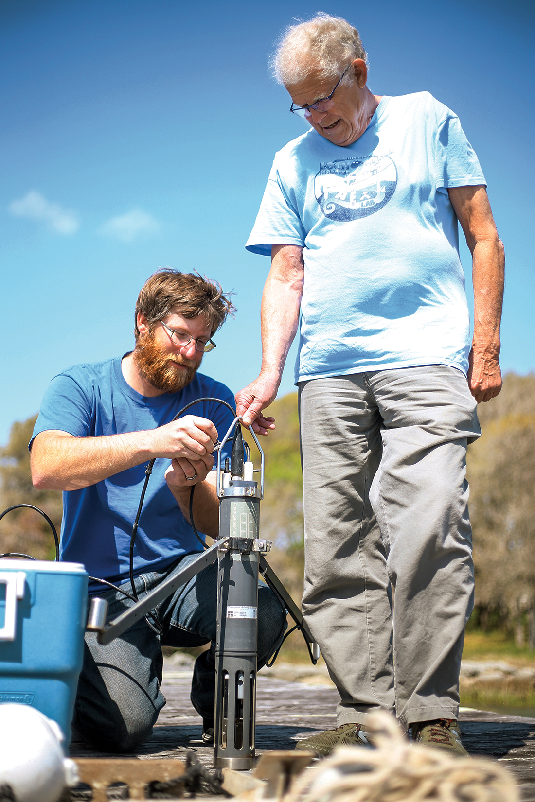
Paerl’s lab now can study storms’ impacts from the perspective of an intensive 25-year monitoring of the lower Neuse River basin and the Pamlico Sound — parts of the country’s second-largest estuarine system. He describes taking the same measurements in the same categories from the same locations, month after month and year after year, as some of the most important work he’s done.
He recalled his graduate school mentor at the University of California-Davis, Charles Goldman, who led the campaign to clean up Lake Tahoe. “I think Charles taught me that — develop a consistent monitoring assessment program and hang your science on that.”
The Neuse River fits under modest highway bridges as it winds from Durham County through the center of eastern North Carolina. Near New Bern it suddenly widens, enough that the town was a significant commercial port in the 19th century.
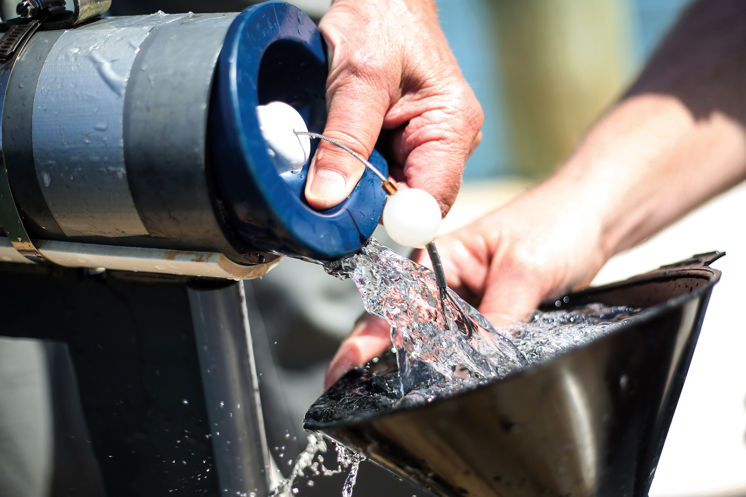
Jeremy Braddy and others in Paerl’s lab use a multi-parameter water quality probe like this one to regularly monitor the Neuse River and Pamlico and Albemarle sounds. (Photo by Mary Lide Parker ’11)
On an April morning, the river is calm at New Bern; it rarely stays that way for the 45-mile ride to its convergence with the Pamlico Sound — where the shores are more than five miles apart but the depth not much more than 20 feet — and today is no exception. The 25-foot boat is bouncing hard on closely spaced waves when it arrives at Station 180.
Jeremy Braddy has been doing this for 15 years, Betsy Abare for eight, and neither technician knows the origin of the numbering of the water monitoring waypoints on the Neuse. Braddy triggers the bow anchor, and the chain rattles loudly on its way out.
He drops a probe into the water and carefully lowers it to the riverbed by hand, stopping every half meter to measure turbidity, salinity, temperature, chlorophyll, pH and dissolved oxygen. A handheld data logger shows him what’s going on below the surface; it’s all being recorded, to be unpacked back at the lab and tossed in with 25 years of data — Paerl’s lab will know the situation now and can compute what’s changed and at what rate.
Meanwhile, Abare drops a hose and pumps river water to take back to the lab, where technicians will measure pigment, carbon, hydrogen, nitrogen and nutrients. Some of her containers will go to the National Oceanic and Atmospheric Administration — IMS is just picking up for NOAA.
“It’s good to get out of the lab for a day,” she says.
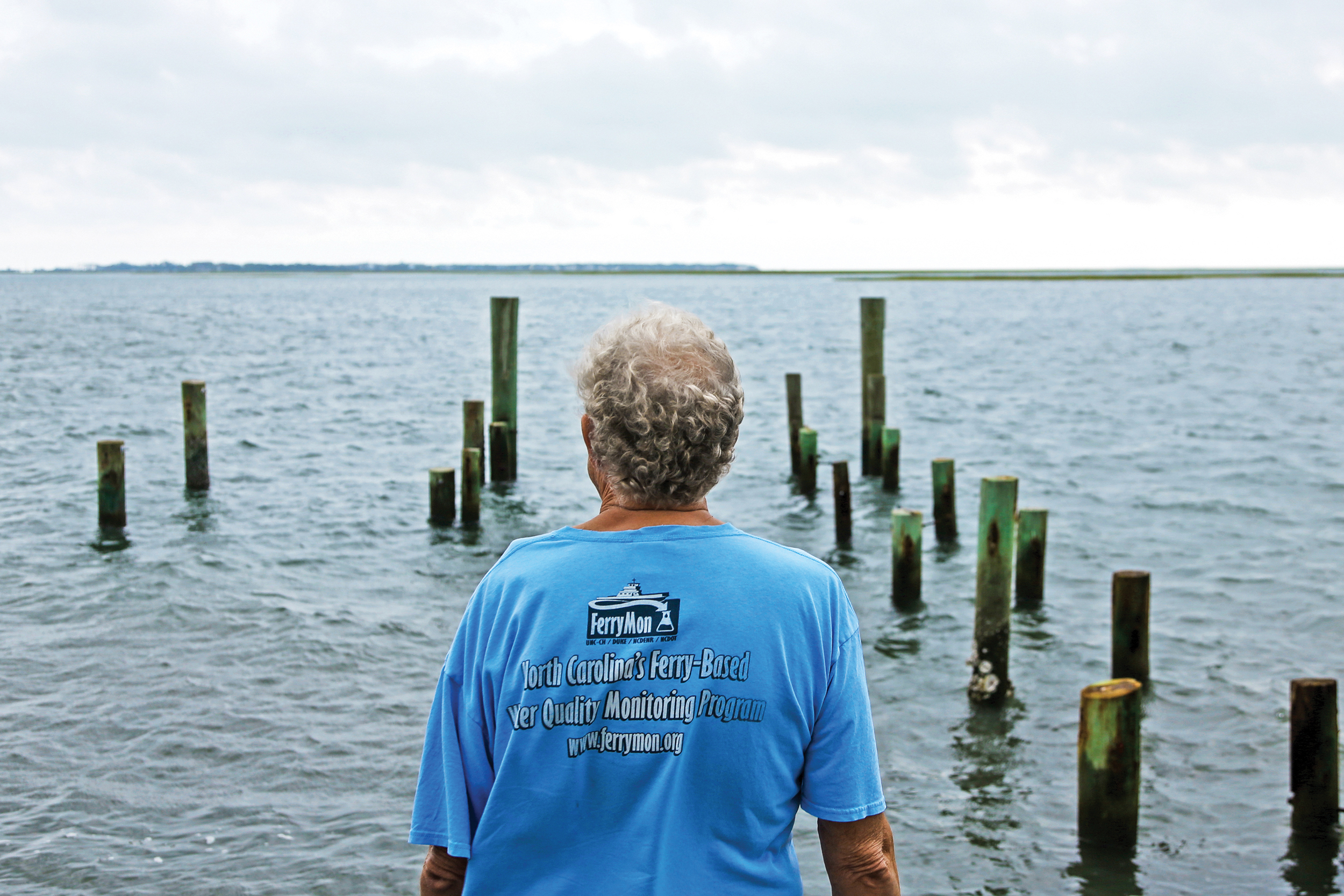
They do this every two to three weeks, weather permitting, and they also tour stations on the Pamlico Sound. Paerl’s lab has had monitoring equipment installed on state-run ferries on the Neuse, the Pamlico and the Pamlico River for the past 20 years.
The ferries, Paerl says, are “the first thing on the water and the last thing off the water. Especially with changing weather conditions and things like that, you know they’re out there at five in the morning and they shut down at midnight. So there’s not much that escapes FerryMon [the Ferry Monitoring Program] in terms of blooms and major problems.”
But Paerl spends a lot of time scratching for funding. “The plodding work of measuring water isn’t sexy — go three to four years after a big storm and everybody forgets the implications.”
When she’s finished filling, Abare suddenly goes low-tech. She drops a Secchi disk (named for the 19th-century Italian who invented it) — a round plate 10 inches in diameter, painted black and white — using a line marked every half meter. When she no longer can make out the black and white, that’s essentially the point at which light isn’t penetrating. She files it mentally and writes it down when she’s done: 0.9 meters at the 180 station; later, 0.4 off Camp Seafarer where the river takes its big turn.
It’s been done this way for 100 years. Eero Asmala, an N.C. State student from Finland who’s along to collect samples for his work, says they do this the same way in the Baltic Sea. And, as in the Neuse, their measurements have been steadily decreasing, reflecting polluting influences on the water.
Everything is repeated at the second station just north of Garbacon Shoal. The stations, in the same places all these years, are not evenly apart but are determined by features that cause different impacts on water quality — the mouth of Adams Creek, the part-manmade arm of the Intracoastal Waterway that carries salt this way; the mouths of smaller creeks; the town of Oriental.
Paerl describes taking the same measurements in the same categories from the same locations, month after month and year after year, as some of the most important work he’s done.
By early afternoon, the crew has repeated its work at 11 stations stretching to a few miles above New Bern. Here, the water that roiled into three-foot waves at the mouth of the Neuse is bathtub-flat and glassy, lined with majestic cypress trees that bear the high-water marks of the hurricane. Ospreys are raising families in nests perched on top of the last of the navigational markers. We are now in completely fresh water.
“This is all runoff from Raleigh,” Braddy says. No mixing with the briny water down river — just the culmination of everything that flows down from Raleigh and everywhere in between.
The IMS crew draws water and electronic measurements and leaves nothing. Braddy’s real-time data will be shared with about 50 other entities, from the state to other marine labs to private interests.
Asmala drops data-gathering devices at four stations that will stay down for a couple of weeks, marked by Styrofoam buoys on which he’s written the IMS phone number and “Do not touch.”
Anybody who messes with his equipment may be startled to find labels that say “University of Helsinki.” Just as with Hans Paerl’s extensive research in China and the Netherlands, scientists worldwide are interested in each other’s water.
“This has been a gold mine,” Paerl said. “Not only have lots of students done their dissertation work on the data we’ve collected, but the state has used our data to evaluate water quality criteria, and also it’s brought in a lot of collaboration and funded projects. There is a long string of funded projects that have kind of hooked their wagon to this. Not only mine but lots of other folks here and at N.C. State and ECU and Duke.”
A forceful advocate
Students have been known to shuffle down the hallways of the IMS in Morehead City, trying to mimic the sound of Paerl’s scary-old bedroom slippers and fool their colleagues into thinking it’s him coming.
He swims almost every morning — in the pool now; it used to be in the sound outside his window — and comes to work in running shoes, jeans and an open shirt for which he has the sun-worn face to match. On the one hand, he’s a pretty fair representative of a beach community. He co-hosts a large-scale annual oyster roast and gets out on his own boat when he can; “I hate to say this, but I’m not a very good fisherman.”
As Paerl looks across the sound outside the Institute of Marine Sciences toward Bogue Banks, it’s not this tidal water he worries about — it’s the nearby inland estuaries where salt water and freshwater mix and where stormwater meets up with the nutrient-rich rivers. (Photo by Mary Lide Parker ’11)
On the other, he is a formidable presence in a lab with no shortage of research stars.
He’s called himself a “pit bull” when a program he believes in needs money, and like most researchers, he has to ask regularly. He’d like for part of his legacy to be recurring funding for the monitoring programs.
He is off the charts as a prodigious publisher of his work. And, as if North Carolina’s massive estuaries aren’t a full-time job, he is a worldwide collaborator with water quality scientists — water quality bears climatic change the same the world over, and the impact of manmade intrusion is the same, in varying degrees.
Another thing Paerl learned from Charles Goldman was how to study over-nutrification at Tahoe, where Goldman’s work was immortalized in the bumper sticker “Keep Tahoe Blue.”
“That’s sort of where I cut my teeth, and basically that’s what I started doing here, too.
“I think the other thing I learned from Charles was how to deal with people — politicians and managers and folks that need to have things explained to them in simple, understandable terms that they care about in terms of the resources and livability and all the other things that are involved with water quality.”
Oversimplified “solutions” to the problems caused by excess nutrients in the water drive Paerl nuts. He laughs ruefully at the “solar bees,” the misbegotten effort to reduce algae growth with dozens of water-stirring devices in Jordan Lake in the Triangle — a project that was scrapped three years ago with more than $1 million spent. “They could have given us that money earlier on to get started with really addressing the question of what’s going to be needed in terms of the reduction [of nutrients] in the watershed.”

Betsy Abare and Paerl discuss nutrient analysis generated by the lab’s auto-analyzer. Paerl also is a fundraiser; grants that support monitoring programs pay for technicians who tend to stay — Abare has eight years with the lab; three others have more than 10 years each. (Photo by Mary Lide Parker ’11)
He has been a forceful advocate for the arduous 20-plus-year task of reducing the nitrogen level in the Neuse by 30 percent. “If we look at the long-term nutrient loading in the Neuse on a year-to-year-to-year basis, I think we’ve gotten to a point where things are stabilized. That doesn’t mean we’ve solved the problem, because we still need to meet that 30 percent reduction in nitrogen, but if we hadn’t had the [mandate] in place things would be much worse. If there’s no target, nobody’s gonna get slapped on the wrist.”
What to do now that he finds himself in “a more stormy world”? More of the same. “The only knob we can tweak in all this is the nutrient valve.”
“We need to deal with this in the watershed because that’s really where the nutrients and a lot of pollutants are coming from,” Paerl said in the immediate aftermath of Florence. Manage the land in the watersheds better. Try to avoid fertilizing during the annual hurricane cycle. Adopt more no-till agriculture. Try to minimize impervious surfaces.
In short, try to keep the nutrients on the land.
The fisheries, he says, must deal with the reality of more and worse storms — avoid overfishing certain species at certain times, invest more in aquaculture in the saltier waters.
“We need to deal with this in the watershed because that’s really where the nutrients and lot of pollutants are coming from.”
— Hans Paerl
“There are citizens groups that are making a lot of noise,” he said as the Florence recovery dragged on. “There are legislators that I think should be concerned about it and rattle some cages up in Raleigh. The environmental agencies obviously need to be concerned. But they’ve been hamstringed by cuts in their funding, which in the Neuse, for example, has put the onus more on us to get the monitoring data.
“Which I don’t mind because it’s leading to good science, something we do here.”
Algal blooms have popped up in the Chowan River and Albemarle Sound, places to the north that had been stable for 25 years. Flooding, not just from hurricanes but from the regular nor’easters, is becoming more frequent in the low-lying stretch along U.S. 70 in eastern Carteret County. A store owner for 40 years on the Beaufort waterfront, Paerl’s wife, Barbara, only recently has started needing sandbags.
The first of those, algal blooms, people can try to control. The weather, they can only watch, and the forecast is for wetter and more chaotic.
David E. Brown ’75 is senior associate editor of the Review.

Thanks for reading the Carolina Alumni Review
Carolina Alumni members, sign in to continue reading.
Not yet a member? Become one today.